27-08-2026
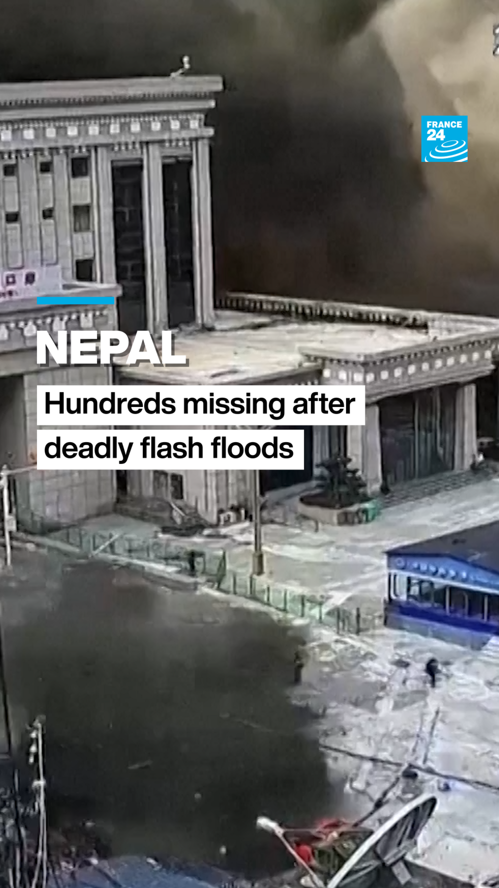
At least 162 people were killed in Nepal after sudden flooding devastated communities near the Nepal-Tibet border, while hundreds of people—including many foreign tourists—remained missing. Nepal’s Tourism Board said 403 people were unaccounted for, including 341 foreign nationals. Those listed as missing included 33 Americans, 34 Australians, 24 Canadians, 19 Malaysians, four Germans and one Israeli. Chinese state media separately reported that 558 people were missing on the Tibet side of the border, including 260 foreigners, and confirmed three deaths from a mudslide at a Tibetan border hub.
The flooding began when water surged through the Bhote Koshi River in northern Nepal’s Rasuwa district, affecting Nuwakot and Dhading and sweeping through villages, roads, bridges, buildings and power infrastructure. The International Red Cross said many areas remained inaccessible, although helicopter teams had rescued some people. Nepal’s mountainous terrain and narrow valleys complicated the response, and helicopters were unable to land in some affected areas.
Authorities initially attributed the disaster to an earthquake and landslide, but the U.S. Geological Survey later determined that a glacial collapse and debris flow caused the flood and that no earthquake had occurred. Six major hydropower and transmission facilities operated by the Nepal Electricity Authority were damaged.
Nepali officials urged residents near the river to move to higher ground and called for intensified rescue and relief efforts. The United States expressed solidarity with Nepal, said it was ready to provide humanitarian assistance and pledged $500,000 through Catholic Relief Services for emergency shelter, relief supplies, and water, sanitation and hygiene support. The U.S. Embassy in Kathmandu was also working with Nepali authorities to locate and assist affected Americans. India placed states along its border with Nepal on high alert.
Entities: Nepal flash floods, Glacial collapse and debris flow, Bhote Koshi River, Nepal-Tibet border, Tibet • Tone: urgent • Sentiment: negative • Intent: inform
27-08-2026
A deadly landslide and flash-flood disaster struck Nepal’s border region with China’s Tibet on August 26, 2026. A torrent of mud, water and debris swept through communities in Nepal’s Rasuwa district, destroying homes, roads and bridges. At least 157 bodies had initially been recovered in Nepal, while later updates put the combined death toll in Nepal and China at 165. Officials warned that the number could rise as rescue teams continued searching for survivors and recovering bodies.
The disaster also caused widespread uncertainty about foreign visitors and local travellers. Nepal’s Department of Tourism said 468 people remained out of contact, including 393 foreigners and 75 Nepalis. A separate hiking group of 47 people, including two children, was reported missing; its members included Australians, Canadians, Nepalis, Americans, Britons, Singaporeans and a Russian-American dual national. Australia’s prime minister said 34 Australians were missing in the border region.
On the Chinese side, state media reported that 558 people were missing in Tibet’s Gyirong county, including 260 foreign nationals, while three deaths had been confirmed there. The United States Geological Survey said the event was not primarily an earthquake, as initially suspected, but a glacial collapse and debris flow that generated catastrophic downstream impacts in Nepal and Tibet.
International assistance began to mobilise. The United States pledged $500,000 in emergency aid and planned to deploy a disaster-response adviser. UN Secretary-General Antonio Guterres said UN teams and partners were preparing supplies and personnel to support affected communities. The France 24 liveblog tracked the evolving casualty and missing-person figures, rescue efforts and official responses.
Entities: Nepal, Tibet, China, Rasuwa district, Nuwakot district and Devighat, France 24 • Tone: urgent • Sentiment: negative • Intent: inform
27-08-2026
The article examines the environmental and geological factors behind deadly floods and landslides along the Nepal-Tibet border on August 26, 2026. At least 160 people were killed and hundreds remained missing after a fast-moving surge of mud, debris, and water overwhelmed communities. Videos showed a wall of material engulfing buildings, buses, and cars.
The precise trigger remains uncertain. Nepal’s Foreign Minister Shishir Khanal initially said an earthquake may have caused a landslide that blocked a river, eventually allowing water to break through. However, the US Geological Survey later determined that seismic energy initially attributed to a magnitude 4.4 earthquake was more likely generated by the landslide itself. The International Centre for Integrated Mountain Development found no unusual activity on the Chinese side and suggested that a rock-ice avalanche in Nepal blocked the Lhende River, producing a cascading flood.
Experts emphasized that the disaster was particularly difficult to predict because there was little or no rainfall beforehand. In the Himalayas, narrow rivers can be rapidly blocked by landslides or avalanches, creating a reservoir that may suddenly burst and send a highly destructive flow downstream. Hydrologist Hatim Sharif said such flows move like “liquid concrete” and cannot realistically be outrun; he recommended climbing at least six metres above the flow. River-level gauges could potentially provide residents with 20 to 30 minutes of warning. Scientists also warned that an upstream blockage could cause another flood.
The article discusses broader climate risks without claiming that climate change caused this specific event. Nepal is vulnerable to glacial lake outburst floods, while rising temperatures, glacier retreat, and permafrost loss may increase the likelihood of landslides and similar hazards. Researchers say a formal event-attribution study will be needed to establish any climate connection.
Entities: Nepal-Tibet border, Himalayas, Nepal, Lhende River, Devighat, Nuwakot District • Tone: analytical • Sentiment: negative • Intent: analyze
27-08-2026
Flash floods and mudslides along the Nepal-Tibet border have killed at least 162 people and left more than 1,000 missing across Nepal and China’s Tibet region, according to figures reported on August 27, 2026. Early reports cited much lower casualty numbers, indicating that the toll was still developing. Authorities said a wall of mud and rock collapsed into a Himalayan river, sending destructive floodwaters through towns and valleys and sweeping away homes, roads, bridges and power infrastructure.
Nepal’s Rasuwa district, including Syapru Besi and Timure, was among the worst-affected areas. Officials said rescue helicopters could not land because river levels remained too high. More than 600 foreigners were reportedly among those missing, while the Nepal Tourism Board separately reported 384 missing travellers, including 291 foreign nationals. In Tibet, officials warned of “major casualties” after a mudslide struck the Gyirong border crossing, severing road, communications and electricity links.
The cause of the disaster had not been confirmed. Nepal’s foreign minister said an earthquake may have triggered an avalanche, while authorities also recalled a deadly Bhote Koshi River flood in 2025 that was attributed to the draining of a supraglacial lake in Tibet. The latest floods affected about 430 megawatts of electricity generation, more than 12 percent of Nepal’s national hydropower capacity.
Police, soldiers and other emergency personnel were deployed to rescue survivors and move residents from low-lying areas. Nepalese officials urged people living near the Bhote Koshi River to seek higher ground and remain alert. China’s President Xi Jinping called for “all-out” search efforts and stronger monitoring and early-warning systems to prevent further disasters. The flooding also threatened a major cross-border transport and trade route, recalling last year’s destruction of a bridge linking Nepal and China.
Entities: Nepal-Tibet border floods, Nepal, Tibet, China, Rasuwa district, Gyirong county and Gyirong port • Tone: urgent • Sentiment: negative • Intent: inform
27-08-2026
A construction worker in Nepal recorded the moment floodwaters and mud swept into Mailung, an area in Rasuwa district, forcing workers to run for safety. The footage captures the sudden arrival of the floodwaters and the dangerous conditions faced by people at the site. The incident is described as a mudslide, with flooding damaging roads and bridges and cutting off access to the affected area.
The worker who filmed the event was later rescued by helicopter. More than 100 other people were also evacuated by air after the damage made road travel difficult or impossible. The report highlights both the immediate danger posed by the mudslide and the emergency response that followed.
Published by Al Jazeera on 27 August 2026, the short news video focuses on firsthand footage from the construction site rather than providing a broader account of the causes or scale of the flooding. It documents the workers’ scramble to escape, the destruction of transport infrastructure, and the subsequent helicopter rescue. The report offers a concise account of a disaster in Nepal and the efforts to bring those affected to safety.
Entities: Nepal, Mailung, Rasuwa district, Construction worker, Floodwaters • Tone: urgent • Sentiment: negative • Intent: inform
27-08-2026
Satellite images from Planet Labs show the dramatic transformation of valleys near Nepal’s border with Tibet after a deadly flash flood on August 26, 2026. Areas that were green and snow-covered before the disaster became covered by brown debris, sediment, ice and boulders. Experts including Vikram Gupta of Sikkim University and Dan Shugar of the University of Calgary believe the event began when the lower section, or snout, of a glacier broke away at roughly 5,200 metres and crashed into a valley about 1,200 metres below. The resulting ice-and-rock avalanche generated a destructive surge that moved through the Lhende, Bhote Koshi and Trishuli river systems.
Initial reports suggested that an earthquake may have triggered the disaster, but the US Geological Survey later determined that the recorded seismic activity was produced by the glacier collapse, falling debris and subsequent movement rather than by a separate earthquake. Satellite images also showed a sharp loss of snow cover shortly before the flood, although experts said it was too early to establish whether warmer conditions contributed to the collapse. The article places the event within Nepal’s broader glacier loss, noting that a 2023 UN assessment found substantial ice loss and accelerating melt linked to global warming.
The disaster caused extensive damage in Rasuwa and nearby districts, including destroyed or disrupted roads, homes, power infrastructure and hydropower facilities. Rescue efforts were hindered by poor weather, failed communications and inaccessible terrain. Nepalese authorities had recovered 157 bodies, while more than 400 tourists remained unaccounted for, including about 340 foreigners. Chinese state media reported deaths and missing people in Tibet’s Gyirong area. The flood also raised concerns downstream in India, prompting evacuations and heightened monitoring in Bihar and Uttar Pradesh. India offered humanitarian assistance to Nepal, while officials continued assessing the risk of further flooding.
Entities: Nepal, Tibet and the Nepal-China border, Planet Labs satellite imagery, Ice-and-rock avalanche, Glacier collapse • Tone: analytical • Sentiment: negative • Intent: inform